


Live Cam Earth Map - GPS Cam
4.1230.00 Reviews
App Specs
- Version
- 71.0
- Updated On
- License
- Free
- Downloads
- 1,000,000+
- Developer
- GambiSoftVn
- Categories
- Maps & Navigation
- Platform
- Android
Screenshots
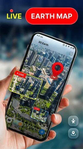
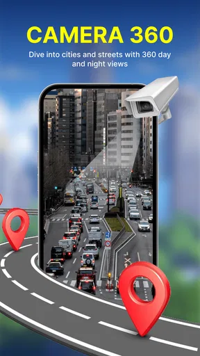
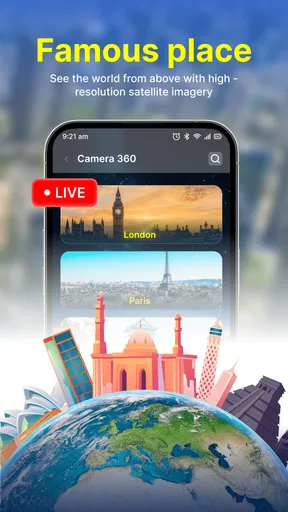
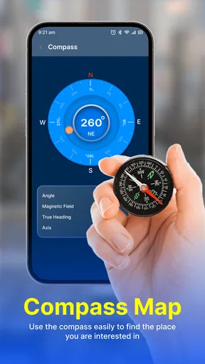
 Analysis by AppCompare
I approached Live Cam Earth Map - GPS Cam as a way to explore places visually, rather than as a replacement for the turn-by-turn navigation I use when I need to get somewhere. That distinction matters: its appeal is the chance to browse well-known destinations and get a sense of places around the world, while its short description points to live-camera and earth-map viewing. If you enjoy planning a trip by looking around before you go, or simply like a few minutes of armchair exploring, that focus makes sense. If your priority is dependable directions on a busy commute, I would reach for a conventional navigation app instead.
A useful way to choose what to explore
I get more from this kind of browsing when I decide what I want to learn before opening a destination. A question such as “Does this place seem central to the city?” gives me a reason to look closely, rather than treating the app as an endless slideshow. I would jot down a landmark that catches my attention, then use a standard map or an official visitor source to check practical details. That two-step approach turns visual curiosity into useful trip research without confusing an impression with a complete plan.
Exploring places without treating it like a route planner
I find this kind of visual browsing most useful when I treat it as a first look at a destination, not a way to settle every travel question. In this section, I’ll focus on how to explore with a specific purpose and turn a quick impression into better questions for later planning. That distinction also helps explain why its strengths differ from those of a conventional route planner.
What the experience is best suited to
The idea behind this Maps & Navigation app is more leisurely than practical. I would use it to pick a destination, browse the area, and get a visual impression before deciding whether a place belongs on a travel plan. A map can answer where something is; a camera-oriented view can make the idea of that place feel more tangible. That is a useful difference for someone choosing between attractions or trying to picture a city they have never visited.
The app is published by GambiSoftVn and is free, so it is easy to try without turning the decision into a purchase. It has a 4.1 average from around 3.3 thousand ratings, with over 1 million installs. Those figures suggest that people are finding a use for it, but they do not tell me whether a particular camera view will be available at the moment I open it. I would treat it as an exploratory companion, not as a guaranteed window onto every landmark.
One useful way to approach it is with a question in mind. Instead of hopping randomly between famous places, I might look up a destination I am considering and use the map and camera concept to orient myself. Is the attraction near a waterfront? Does the surrounding area look like a dense city center or a more open setting? This kind of visual preview can help me decide what to research next, though it should not replace current local guidance when timing, access, or conditions matter.
Where it fits beside familiar map apps
Most people already have a standard map app that is better suited to finding an address, checking a route, or navigating while moving. Live Cam Earth Map has a different reason to be opened: visual discovery. I see it as complementary, much like browsing a place before using a dedicated route planner. That division of labor keeps expectations realistic and avoids the frustration of asking a sightseeing-focused tool to do a navigation app’s job.
Worth Reading Before You Choose

Flipboard Shows What News Apps Must Do Beyond the Feed

Switching to Android Auto Means Rethinking Your Driving Routine

Google Calendar Makes a Crowded Week Easier to Manage

Ludo King Makes the Most of the Minutes Between Plans

Baby Panda World Brings Quick Play to Modern Phones, but Its Game Library Feels Busy

ESPN’s Live Game View Makes Following Close Games Easier
For trip planning, I would use it early in the process, when I am comparing destinations or trying to build a mental picture of a place. Once I need opening hours, transit choices, walking directions, or the best way to reach a specific entrance, I would switch to a service built around current travel information. A live or camera-based view can be engaging, but a visual glimpse is not the same thing as an up-to-date itinerary.
A practical browsing routine
A small habit can make this sort of app more useful: choose one destination, inspect the view, then note what questions remain instead of assuming the first impression settles them. For instance, if I am considering a famous square, I can use the visual browsing experience to understand its setting, then check a regular map for nearby streets and a current source for access details. This keeps the app’s strongest contribution—helping a place feel less abstract—separate from information that needs to be precise and current.
It also helps to browse with a purpose when using the app casually. I might compare two landmarks in the same city rather than jumping across the globe every few seconds. That makes it easier to remember what I saw and gives the exploration a little structure. The app’s worldwide attraction focus is naturally broad, but a broad catalog can become aimless if I do not bring my own shortlist or travel question.
Speed expectations and demanding sessions
I would set modest expectations for perceived speed. The experience depends on looking at map and camera-oriented content, so the time it takes to load a particular view may depend on the connection and the content being opened. I would not judge the whole app by one slow transition, nor would I assume that every destination will appear instantly. For a quick browse on a stable connection, the concept is straightforward; for a long session moving rapidly between distant places, I would expect more opportunities for loading pauses.
Heavy use is most likely when I am exploring many attractions in succession, leaving the app open while comparing destinations, or returning repeatedly to different views. A practical tip is to browse a few places at a time and pause to decide what is actually useful. That is not just easier on attention; it also avoids treating a camera view as something that must be continuously refreshed. If a view seems slow or fails to become useful, I would move on and check the destination later rather than repeatedly reopening it in a hurry.
For an everyday scenario, imagine a rainy evening when I am choosing what to see on an upcoming city break. I could open the app, browse a couple of famous locations, and use the visual context to narrow down which ones interest me. Then I would save the actual logistics for a regular map and travel information source. In that setting, a brief delay is an inconvenience rather than a trip problem. If I were already outside trying to meet someone at a precise spot, that same delay would matter much more, and this would not be my first choice.
Reliability, connection, and recovery
Reliability here is best understood as a combination of whether the app opens smoothly and whether the specific content I want is useful when I check it. A camera-based destination view can be less predictable than a static map, so I would avoid building a time-sensitive plan around seeing a particular scene. The app can be a pleasant way to explore, but I would keep a backup source for directions and any decision that depends on current conditions.
If a view does not load as expected, I would try the simple recovery steps first: check the connection, return to the map, and select the destination again. If the problem persists, I would leave that location for later rather than repeatedly tapping through the same path. This is a sensible approach for any app whose appeal depends on viewing remote places, and it prevents a temporary hiccup from turning a casual browse into a frustrating session.
I would also distinguish visual orientation from proof of what a place is like right now. A view may help me recognize a landmark or understand its broad setting, but it should not be treated as confirmation of crowd levels, access, weather, or operating status. That is an important limitation for visitors: use the app to become curious and oriented, then verify practical details elsewhere before making a journey.
Device fit and daily use
The app is rated for Everyone and is listed for devices running Android 7.0 or later, which gives it a broad age and compatibility range. Its current version is 71.0. Those details make it approachable for many Android users, but the minimum operating-system requirement alone cannot tell me how comfortable it will feel on every device. A phone with limited resources or an older connection may make map-and-camera browsing less pleasant than a newer, more responsive setup.
I would be especially considerate of battery and data if I planned a long browsing session away from Wi-Fi. Map imagery and camera-oriented content can involve more loading than reading a simple text page, so short, deliberate sessions are the safer habit when resources are tight. I would not assume the app is unusually demanding, but I would also avoid leaving it running for hours just because the subject is interesting. Close it when I am done, and use a stable connection for an extended look around.
For families, the Everyone rating makes the app broadly suitable from an age-label perspective, while the worldwide exploration angle can give adults and children a shared way to talk about places. I would still guide younger users toward a destination or theme rather than letting browsing become endless. For someone who needs accessibility-specific tools, detailed route guidance, or dependable offline navigation, I would compare those needs against the dedicated options they already use instead of assuming this app covers them.
Who will enjoy it, and who should pass
I think it is a good fit for curious travelers, people who enjoy looking at famous destinations from home, and anyone who wants a visual starting point for trip research. It can also suit a short break between tasks: choose a place, look around, and come away with a better sense of its setting. Its free access lowers the barrier to trying that style of exploration, and the app’s broad attraction focus gives browsing a clear subject.
I would skip it as a primary tool if I need reliable turn-by-turn directions, detailed local transit planning, guaranteed current camera coverage, or a trustworthy answer about conditions on the ground. In those cases, a conventional maps service or an official destination resource is a better fit. I would also be less enthusiastic if I only want a fast address lookup; opening a visual exploration app for that simple task may add steps without adding much value.
My performance verdict
My overall view is that Live Cam Earth Map - GPS Cam makes the most sense as a lightweight exploration companion, not an all-purpose navigation solution. Its strongest use is helping me picture famous places and decide what I want to investigate further. The trade-off is that camera-oriented browsing is inherently less suitable for urgent logistics, and a remote view should not be mistaken for a complete, real-time account of a destination.
I would keep it in my travel-planning mix if I enjoy visual discovery, while relying on established navigation tools for routes and practical decisions. The app’s 4.1 average and substantial install base make it a reasonable candidate to try, but the right test is simple: open a destination you genuinely care about and see whether the view helps you understand it. If it does, the app has earned a place in your browsing routine. If you need directions first and curiosity second, another map app will serve you better.
Final recommendation for a curious traveler
My recommendation is to use it with a clear, limited purpose: explore a landmark, get a broad visual impression, and then verify anything that affects your plans through a more practical source. That approach brings out the app’s appeal without asking it to promise more than a camera-and-map experience can deliver. For leisurely destination discovery, it is worth a try; for navigation you cannot afford to get wrong, keep a dedicated route planner close by.
A final decision before installing
If you are deciding whether it belongs on your phone, I would ask what you want to do in the next few minutes. For browsing a place you have never seen, it has a clear purpose; for getting across town, it is the wrong tool to depend on. That distinction also makes it easier to judge a first session fairly: choose a familiar attraction, see whether the visual view adds context, and decide from that experience rather than expecting a full navigation suite.
That is why I see its best role as a small, occasional part of travel planning, not an app I would keep open throughout a day of moving around. Use it when curiosity is the goal, and move to a regular map when accuracy and timing take over. Live Cam Earth Map - GPS Cam is most appealing when those expectations are clear.
Pros
- Combines live camera feeds with map-based location browsing.
- GPS map makes it easy to explore cameras by geographic area.
- Useful for a quick look at places around the world from your phone.
- Simple concept that is easy to understand without a long setup.
- Can make virtual sightseeing more engaging than browsing a plain map.
Cons
- Camera feeds may be unavailable
- offline
- or temporarily interrupted.
- Image quality and refresh rates can vary from camera to camera.
- Some locations may have very few cameras to explore.
- Live feeds can use substantial mobile data
- especially over long sessions.
- Camera coverage may not be truly real-time or available in every region.
FAQs for Live Cam Earth Map - GPS Cam
What is Live Cam Earth Map - GPS Cam?
Live Cam Earth Map - GPS Cam is presented as a location-focused camera and map app. Its name suggests features for viewing map information alongside camera imagery, but the exact sources, coverage, and tools available can vary by version. Before installing, check the app’s current store listing and screenshots to confirm what it offers in your region; do not assume it provides unrestricted live video of any place on Earth.
Does Live Cam Earth Map - GPS Cam show genuinely live cameras everywhere?
Not necessarily. Apps that advertise live maps or cameras may combine map services, publicly available camera feeds, still images, or other location-based content, and availability can differ substantially from one place to another. A map view does not mean every location has a live camera. Review the app description and any in-app labels to see whether a feed is live, delayed, or unavailable, and treat promotional imagery as an indication rather than a guarantee.
Does the app need access to my location or camera?
Permission needs depend on the features you choose to use. A GPS-related app may request location access to show your position or nearby places, while camera access may be needed if you take photos within the app. You can usually deny permissions that are not essential, though some functions may then be limited. Check the permission prompts carefully, and consult the store listing and privacy policy to understand how location or image data may be handled.
Is Live Cam Earth Map - GPS Cam free to download and use?
The app may be available to download without an upfront charge, but that does not necessarily mean every feature is free. Some versions of apps in this category include advertising, optional purchases, or subscriptions that unlock additional tools or remove ads. Pricing and available options can change by platform, country, and update. Check the current Google Play or App Store listing and confirm any purchase terms before subscribing or entering payment details.
What should I check before downloading Live Cam Earth Map - GPS Cam?
First, verify that the app is compatible with your Android or iOS device and that its latest listing matches the features you want. Read recent user reviews for reports about camera availability, map accuracy, ads, and reliability, since these can change with updates. Also review its developer information, permissions, privacy policy, and any subscription terms. Download it only from an official app store, and avoid relying on it for emergency or safety-critical information.


